
Thank you for supporting this site ❤️
Make a donation
Make a donation
Johor River topographic map
Click on the map to display elevation.
Thank you for supporting this site ❤️
Make a donation
Make a donation
About this map
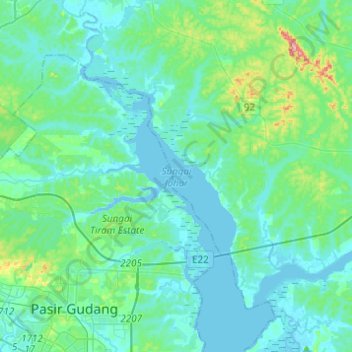
Name: Johor River topographic map, elevation, terrain.
Location: Johor River, Kota Tinggi, Johor, Malaysia (1.46495 103.91198 1.70956 104.06140)
Average elevation: 24 m
Minimum elevation: -7 m
Maximum elevation: 168 m
Thank you for supporting this site ❤️
Make a donation
Make a donation
Other topographic maps
Click on a map to view its topography, its elevation and its terrain.