
Make a donation
Daviess County topographic map
Click on the map to display elevation.
Make a donation
Daviess County
The terrain of Daviess County is hilly, with its area completely devoted to agriculture or urban development. Its highest elevation (740 ft; 230 m ASL) is a rise one mile (1.6 km) NNE of Farlen. The county is drained by the White River flowing to the southwest, whose two main forks (East White and West White) come together at the county's SW corner. The county's west boundary is defined by the West White River's course and its south boundary is defined by the East White River's course; their confluence defines the county's corner point.
Make a donation
About this map
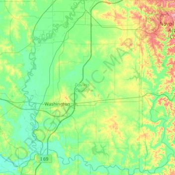
Name: Daviess County topographic map, elevation, terrain.
Location: Daviess County, Indiana, United States (38.49037 -87.27942 38.90418 -86.90423)
Average elevation: 154 m
Minimum elevation: 123 m
Maximum elevation: 251 m
Make a donation
Other topographic maps
Click on a map to view its topography, its elevation and its terrain.