
Thank you for supporting this site ❤️
Make a donation
Make a donation
Agatu topographic map
Click on the map to display elevation.
Thank you for supporting this site ❤️
Make a donation
Make a donation
About this map
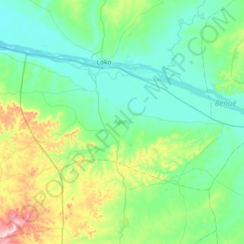
Name: Agatu topographic map, elevation, terrain.
Location: Agatu, Benue, Nigeria (7.72943 7.66364 8.01447 8.18036)
Average elevation: 128 m
Minimum elevation: 44 m
Maximum elevation: 501 m
Thank you for supporting this site ❤️
Make a donation
Make a donation