
Thank you for supporting this site ❤️
Make a donation
Make a donation
Farge topographic map
Click on the map to display elevation.
Thank you for supporting this site ❤️
Make a donation
Make a donation
About this map
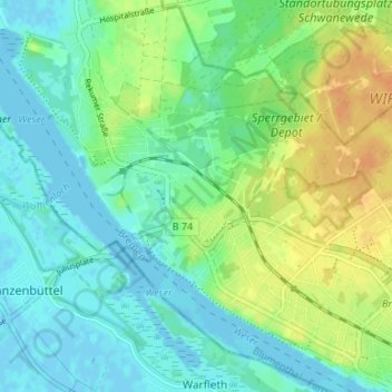
Name: Farge topographic map, elevation, terrain.
Location: Farge, Blumenthal, Bremen-Nord, Bremen, Deutschland (53.18983 8.50192 53.21543 8.56820)
Average elevation: 11 m
Minimum elevation: -2 m
Maximum elevation: 31 m
Thank you for supporting this site ❤️
Make a donation
Make a donation
Other topographic maps
Click on a map to view its topography, its elevation and its terrain.