
Thank you for supporting this site ❤️
Make a donation
Make a donation
Gusau topographic map
Click on the map to display elevation.
Thank you for supporting this site ❤️
Make a donation
Make a donation
About this map
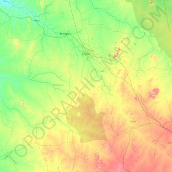
Name: Gusau topographic map, elevation, terrain.
Location: Gusau, Zamfara State, Nigeria (11.56477 6.52919 12.43724 7.15685)
Average elevation: 498 m
Minimum elevation: 336 m
Maximum elevation: 838 m
Thank you for supporting this site ❤️
Make a donation
Make a donation
Other topographic maps
Click on a map to view its topography, its elevation and its terrain.