
Thank you for supporting this site ❤️
Make a donation
Make a donation
Etchison topographic map
Click on the map to display elevation.
Thank you for supporting this site ❤️
Make a donation
Make a donation
About this map
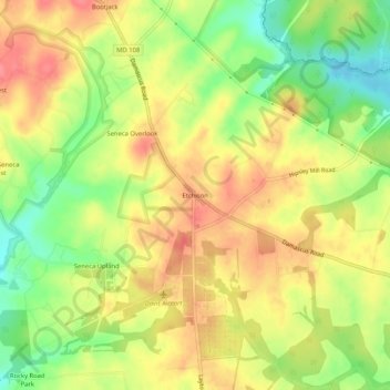
Name: Etchison topographic map, elevation, terrain.
Location: Etchison, Montgomery County, Maryland, 20882, United States (39.23455 -77.16359 39.27455 -77.12359)
Average elevation: 173 m
Minimum elevation: 133 m
Maximum elevation: 205 m
Thank you for supporting this site ❤️
Make a donation
Make a donation