
Goslar topographic map
Interactive map
Click on the map to display elevation.
About this map
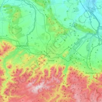
Name: Goslar topographic map, elevation, terrain.
Location: Goslar, Landkreis Goslar, Lower Saxony, Germany (51.84388 10.31732 52.00593 10.65119)
Average elevation: 311 m
Minimum elevation: 91 m
Maximum elevation: 762 m