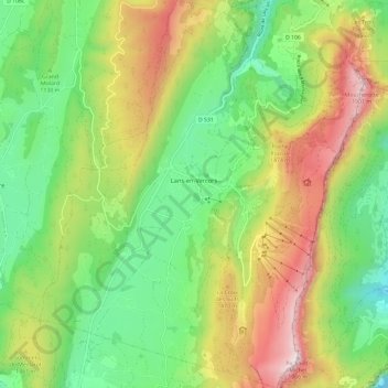
Lans-en-Vercors topographic map
Interactive map
Click on the map to display elevation.
About this map
Name: Lans-en-Vercors topographic map, elevation, terrain.
Average elevation: 1,215 m
Minimum elevation: 733 m
Maximum elevation: 1,951 m

Click on the map to display elevation.
Name: Lans-en-Vercors topographic map, elevation, terrain.
Average elevation: 1,215 m
Minimum elevation: 733 m
Maximum elevation: 1,951 m