
Kerlingarfjöll topographic map
Interactive map
Click on the map to display elevation.
About this map
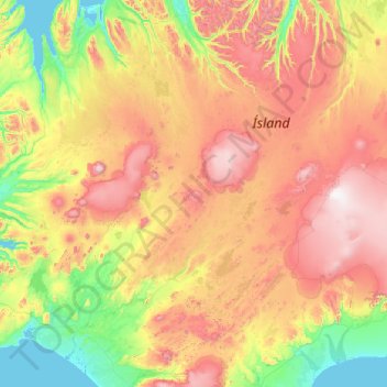
Name: Kerlingarfjöll topographic map, elevation, terrain.
Location: Kerlingarfjöll, Hrunamannahreppur, Southern Region, Iceland (63.62416 -20.25835 65.62416 -18.25835)
Average elevation: 558 m
Minimum elevation: -4 m
Maximum elevation: 2,000 m
Other topographic maps
Click on a map to view its topography, its elevation and its terrain.
Fludir
Fludir, Hrunamannahreppur, Southern Region, 845, Iceland
Average elevation: 95 m