
Thank you for supporting this site ❤️
Make a donation
Make a donation
Morristown topographic map
Click on the map to display elevation.
Thank you for supporting this site ❤️
Make a donation
Make a donation
About this map
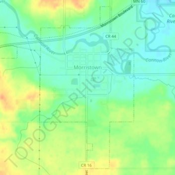
Name: Morristown topographic map, elevation, terrain.
Location: Morristown, Rice County, Minnesota, United States (44.21082 -93.46454 44.23582 -93.43436)
Average elevation: 316 m
Minimum elevation: 301 m
Maximum elevation: 336 m
Thank you for supporting this site ❤️
Make a donation
Make a donation
Other topographic maps
Click on a map to view its topography, its elevation and its terrain.
Thank you for supporting this site ❤️
Make a donation
Make a donation
Thank you for supporting this site ❤️
Make a donation
Make a donation