
Thank you for supporting this site ❤️
Make a donation
Make a donation
Walker topographic map
Click on the map to display elevation.
Thank you for supporting this site ❤️
Make a donation
Make a donation
About this map
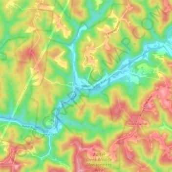
Name: Walker topographic map, elevation, terrain.
Location: Walker, Wood County, West Virginia, United States (39.15973 -81.40414 39.19973 -81.36414)
Average elevation: 250 m
Minimum elevation: 185 m
Maximum elevation: 311 m
Thank you for supporting this site ❤️
Make a donation
Make a donation
Other topographic maps
Click on a map to view its topography, its elevation and its terrain.