
O Chao topographic map
Interactive map
Click on the map to display elevation.
About this map
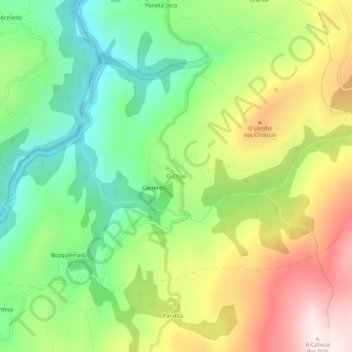
Name: O Chao topographic map, elevation, terrain.
Average elevation: 1,112 m
Minimum elevation: 763 m
Maximum elevation: 1,604 m
Other topographic maps
Click on a map to view its topography, its elevation and its terrain.
Chandrexa de Queixa
España > Galicia > Tierra de Trives > Chandrexa de Queixa
Chandrexa de Queixa, Tierra de Trives, Orense, Galicia, 32786, España
Average elevation: 1,183 m