
Khunnu topographic map
Click on the map to display elevation.
About this map
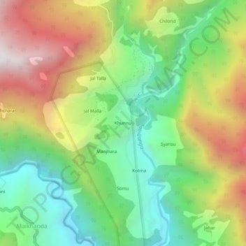
Name: Khunnu topographic map, elevation, terrain.
Location: Khunnu, Ukhimath, Rudraprayag District, Uttarakhand, India (30.56873 79.05596 30.60873 79.09596)
Average elevation: 1,841 m
Minimum elevation: 1,226 m
Maximum elevation: 2,718 m
Other topographic maps
Click on a map to view its topography, its elevation and its terrain.