
Thank you for supporting this site ❤️
Make a donation
Make a donation
Ruchsen topographic map
Click on the map to display elevation.
Thank you for supporting this site ❤️
Make a donation
Make a donation
Ruchsen
Ruchsen liegt an der Einmündung des Hergstbachs in die Jagst. Die bebaute Fläche liegt in etwa 180 bis 215 Metern Höhe.
Thank you for supporting this site ❤️
Make a donation
Make a donation
About this map
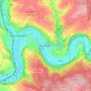
Name: Ruchsen topographic map, elevation, terrain.
Average elevation: 257 m
Minimum elevation: 170 m
Maximum elevation: 345 m
Thank you for supporting this site ❤️
Make a donation
Make a donation