
Thank you for supporting this site ❤️
Make a donation
Make a donation
Anticosti Island topographic map
Click on the map to display elevation.
Thank you for supporting this site ❤️
Make a donation
Make a donation
About this map
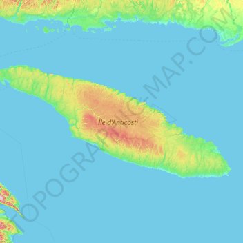
Name: Anticosti Island topographic map, elevation, terrain.
Location: Anticosti Island, Minganie, Côte-Nord, Quebec, Canada (49.04419 -64.56002 49.96809 -61.64325)
Average elevation: 30 m
Minimum elevation: -1 m
Maximum elevation: 511 m
Thank you for supporting this site ❤️
Make a donation
Make a donation