Geolocate
👉 Easily get elevation data in JSON, GeoTIFF and KML formats using Elevation API
Thank you for supporting this site ❤️
Make a donation

Orile topographic map

Click on the map to display elevation.

👉 Easily get elevation data in JSON, GeoTIFF and KML formats using Elevation API
Thank you for supporting this site ❤️
Make a donation

About this map

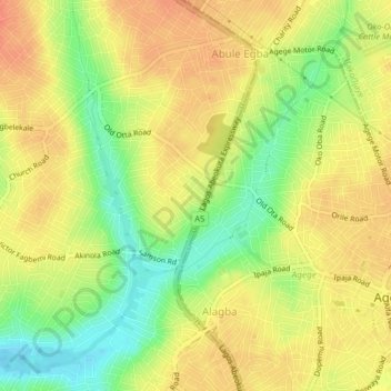
Name: Orile topographic map, elevation, terrain.

Location: Orile, Alimosho, Lagos State, Nigeria (6.61333 3.28000 6.65333 3.32000)

Average elevation: 38 m

Minimum elevation: 11 m

Maximum elevation: 56 m