
Thank you for supporting this site ❤️
Make a donation
Make a donation
Brooken Mountain topographic map
Click on the map to display elevation.
Thank you for supporting this site ❤️
Make a donation
Make a donation
About this map
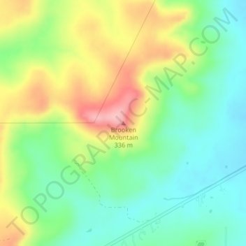
Name: Brooken Mountain topographic map, elevation, terrain.
Location: Brooken Mountain, Haskell County, Oklahoma, United States (35.23199 -95.40280 35.23209 -95.40270)
Average elevation: 250 m
Minimum elevation: 195 m
Maximum elevation: 338 m
Thank you for supporting this site ❤️
Make a donation
Make a donation
Other topographic maps
Click on a map to view its topography, its elevation and its terrain.