
Thank you for supporting this site ❤️
Make a donation
Make a donation
Cleo Springs topographic map
Click on the map to display elevation.
Thank you for supporting this site ❤️
Make a donation
Make a donation
About this map
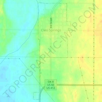
Name: Cleo Springs topographic map, elevation, terrain.
Location: Cleo Springs, Major County, Oklahoma, 73729, United States (36.38693 -98.44643 36.41257 -98.43284)
Average elevation: 387 m
Minimum elevation: 374 m
Maximum elevation: 400 m
Thank you for supporting this site ❤️
Make a donation
Make a donation
Other topographic maps
Click on a map to view its topography, its elevation and its terrain.