
Thank you for supporting this site ❤️
Make a donation
Make a donation
Sint-Antonius topographic map
Click on the map to display elevation.
Thank you for supporting this site ❤️
Make a donation
Make a donation
About this map
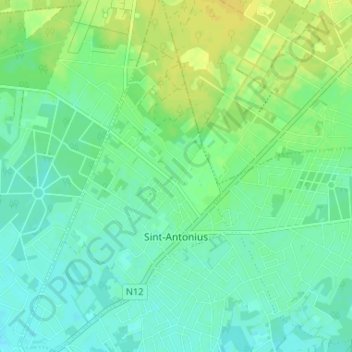
Name: Sint-Antonius topographic map, elevation, terrain.
Location: Sint-Antonius, Zoersel, Antwerpen, België (51.25305 4.60786 51.29386 4.64647)
Average elevation: 17 m
Minimum elevation: 9 m
Maximum elevation: 29 m
Thank you for supporting this site ❤️
Make a donation
Make a donation