
Bankura topographic map
Interactive map
Click on the map to display elevation.
About this map
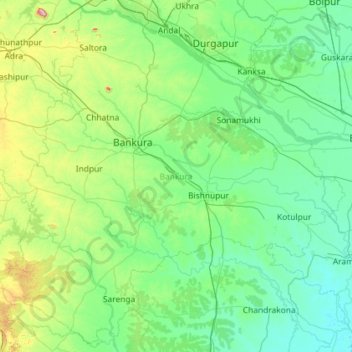
Name: Bankura topographic map, elevation, terrain.
Location: Bankura, West Bengal, India (22.62621 86.60886 23.63747 87.76368)
Average elevation: 86 m
Minimum elevation: 4 m
Maximum elevation: 600 m
Other topographic maps
Click on a map to view its topography, its elevation and its terrain.