
Shiloh topographic map
Interactive map
Click on the map to display elevation.
About this map
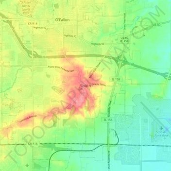
Name: Shiloh topographic map, elevation, terrain.
Location: Shiloh, Saint Clair County, Illinois, 62269, United States (38.52144 -89.93732 38.60144 -89.85732)
Average elevation: 158 m
Minimum elevation: 126 m
Maximum elevation: 205 m