
Shinjō topographic map
Interactive map
Click on the map to display elevation.
About this map
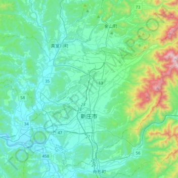
Name: Shinjō topographic map, elevation, terrain.
Location: Shinjō, Préfecture de Yamagata, Japon (38.69727 140.19286 38.90276 140.49430)
Average elevation: 229 m
Minimum elevation: 25 m
Maximum elevation: 1,207 m