
Thank you for supporting this site ❤️
Make a donation
Make a donation
York River topographic map
Click on the map to display elevation.
Thank you for supporting this site ❤️
Make a donation
Make a donation
About this map
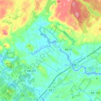
Name: York River topographic map, elevation, terrain.
Location: York River, York, York County, Maine, United States (43.12783 -70.77279 43.18813 -70.64281)
Average elevation: 31 m
Minimum elevation: -5 m
Maximum elevation: 110 m
Thank you for supporting this site ❤️
Make a donation
Make a donation
Other topographic maps
Click on a map to view its topography, its elevation and its terrain.