
Thank you for supporting this site ❤️
Make a donation
Make a donation
Sugar Land topographic map
Click on the map to display elevation.
Thank you for supporting this site ❤️
Make a donation
Make a donation
About this map
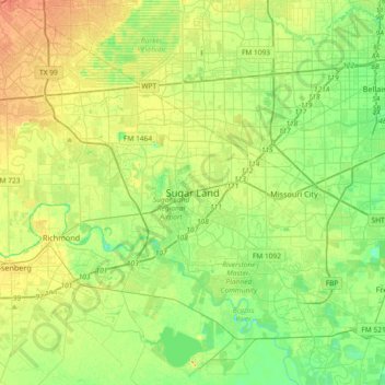
Name: Sugar Land topographic map, elevation, terrain.
Location: Sugar Land, Fort Bend County, Texas, 77478, United States (29.45968 -95.79495 29.77968 -95.47495)
Average elevation: 25 m
Minimum elevation: 10 m
Maximum elevation: 45 m
Thank you for supporting this site ❤️
Make a donation
Make a donation