
Thank you for supporting this site ❤️
Make a donation
Make a donation
Altstätten topographic map
Click on the map to display elevation.
Thank you for supporting this site ❤️
Make a donation
Make a donation
About this map
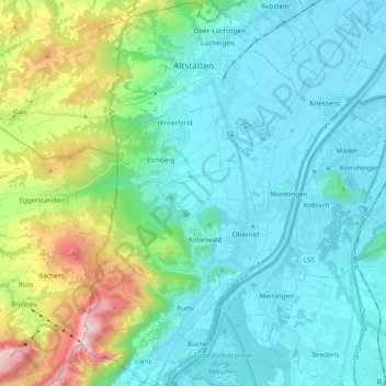
Name: Altstätten topographic map, elevation, terrain.
Location: Altstätten, Wahlkreis Rheintal, St. Gallen, Switzerland (47.26893 9.48395 47.40027 9.59320)
Average elevation: 679 m
Minimum elevation: 403 m
Maximum elevation: 1,785 m
Thank you for supporting this site ❤️
Make a donation
Make a donation
Other topographic maps
Click on a map to view its topography, its elevation and its terrain.