
Thank you for supporting this site ❤️
Make a donation
Make a donation
Shellrock Spring topographic map
Click on the map to display elevation.
Thank you for supporting this site ❤️
Make a donation
Make a donation
About this map
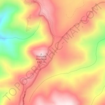
Name: Shellrock Spring topographic map, elevation, terrain.
Average elevation: 1,157 m
Minimum elevation: 853 m
Maximum elevation: 1,345 m
Thank you for supporting this site ❤️
Make a donation
Make a donation
Other topographic maps
Click on a map to view its topography, its elevation and its terrain.
Cascade Locks Marine Park
United States > Oregon > Hood River County > Cascade Locks
Average elevation: 72 m