
Thank you for supporting this site ❤️
Make a donation
Make a donation
Haleys Corner topographic map
Click on the map to display elevation.
Thank you for supporting this site ❤️
Make a donation
Make a donation
About this map
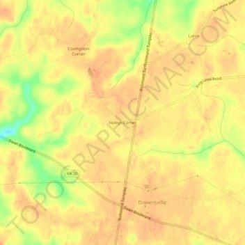
Name: Haleys Corner topographic map, elevation, terrain.
Location: Haleys Corner, Caroline County, Virginia, United States (37.82820 -77.38915 37.86820 -77.34915)
Average elevation: 60 m
Minimum elevation: 31 m
Maximum elevation: 68 m
Thank you for supporting this site ❤️
Make a donation
Make a donation
Other topographic maps
Click on a map to view its topography, its elevation and its terrain.