Thank you for supporting this site ❤️
Make a donation
Make a donation
Writtle topographic map
Click on the map to display elevation.
Thank you for supporting this site ❤️
Make a donation
Make a donation
About this map
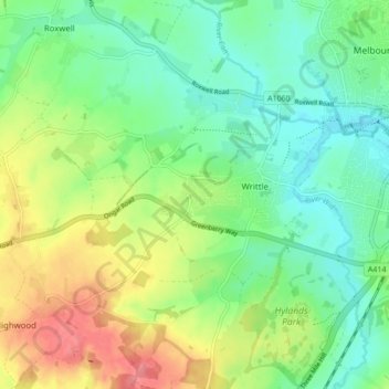
Name: Writtle topographic map, elevation, terrain.
Location: Writtle, Chelmsford, Essex, England, United Kingdom (51.70189 0.37269 51.75507 0.44732)
Average elevation: 52 m
Minimum elevation: 24 m
Maximum elevation: 99 m
Thank you for supporting this site ❤️
Make a donation
Make a donation
Other topographic maps
Click on a map to view its topography, its elevation and its terrain.
