
Thank you for supporting this site ❤️
Make a donation
Make a donation
Terre Rouge topographic map
Click on the map to display elevation.
Thank you for supporting this site ❤️
Make a donation
Make a donation
About this map
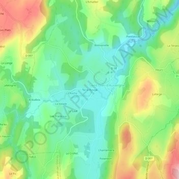
Name: Terre Rouge topographic map, elevation, terrain.
Average elevation: 501 m
Minimum elevation: 422 m
Maximum elevation: 642 m
Thank you for supporting this site ❤️
Make a donation
Make a donation
Other topographic maps
Click on a map to view its topography, its elevation and its terrain.
63520
France > Auvergne-Rhône-Alpes > Puy-de-Dôme > Saint-Dier-d'Auvergne > Boissonelle
Average elevation: 483 m