
Thank you for supporting this site ❤️
Make a donation
Make a donation
Rüti (ZH) topographic map
Click on the map to display elevation.
Thank you for supporting this site ❤️
Make a donation
Make a donation
About this map
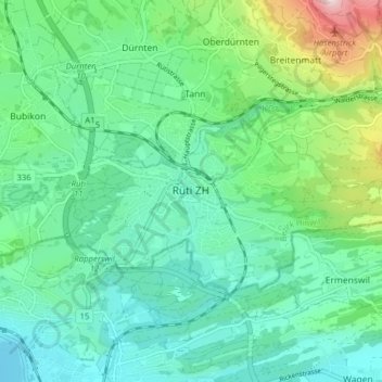
Name: Rüti (ZH) topographic map, elevation, terrain.
Location: Rüti (ZH), Bezirk Hinwil, Zurich, 8630, Switzerland (47.24326 8.82712 47.27237 8.90562)
Average elevation: 516 m
Minimum elevation: 402 m
Maximum elevation: 889 m
Thank you for supporting this site ❤️
Make a donation
Make a donation
Other topographic maps
Click on a map to view its topography, its elevation and its terrain.