
Le Mas de Barrade topographic map
Interactive map
Click on the map to display elevation.
About this map
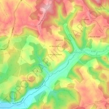
Name: Le Mas de Barrade topographic map, elevation, terrain.
Average elevation: 294 m
Minimum elevation: 196 m
Maximum elevation: 374 m
Other topographic maps
Click on a map to view its topography, its elevation and its terrain.
Le Mas de Nadal
France > Occitanie > Lot > Gigouzac
Le Mas de Nadal, Gigouzac, Cahors, Lot, Occitanie, France métropolitaine, 46150, France
Average elevation: 311 m