
Thank you for supporting this site ❤️
Make a donation
Make a donation
Kaukauna topographic map
Click on the map to display elevation.
Thank you for supporting this site ❤️
Make a donation
Make a donation
About this map
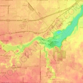
Name: Kaukauna topographic map, elevation, terrain.
Location: Kaukauna, Outagamie County, Wisconsin, 54130, United States (44.24295 -88.29326 44.31557 -88.23229)
Average elevation: 216 m
Minimum elevation: 171 m
Maximum elevation: 234 m
Thank you for supporting this site ❤️
Make a donation
Make a donation
Other topographic maps
Click on a map to view its topography, its elevation and its terrain.