
Enugu East topographic map
Interactive map
Click on the map to display elevation.
About this map
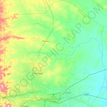
Name: Enugu East topographic map, elevation, terrain.
Location: Enugu East, Enugu State, Nigeria (6.44819 7.45924 6.65398 7.65743)
Average elevation: 172 m
Minimum elevation: 81 m
Maximum elevation: 386 m
Other topographic maps
Click on a map to view its topography, its elevation and its terrain.