
Thank you for supporting this site ❤️
Make a donation
Make a donation
Demsa topographic map
Click on the map to display elevation.
Thank you for supporting this site ❤️
Make a donation
Make a donation
About this map
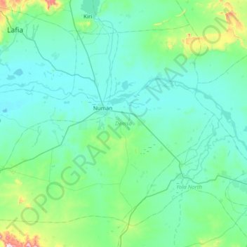
Name: Demsa topographic map, elevation, terrain.
Location: Demsa, Adamawa State, Nigeria (9.17809 11.69885 9.66571 12.31353)
Average elevation: 214 m
Minimum elevation: 130 m
Maximum elevation: 861 m
Thank you for supporting this site ❤️
Make a donation
Make a donation
Other topographic maps
Click on a map to view its topography, its elevation and its terrain.