
Thank you for supporting this site ❤️
Make a donation
Make a donation
Long Ampung topographic map
Click on the map to display elevation.
Thank you for supporting this site ❤️
Make a donation
Make a donation
About this map
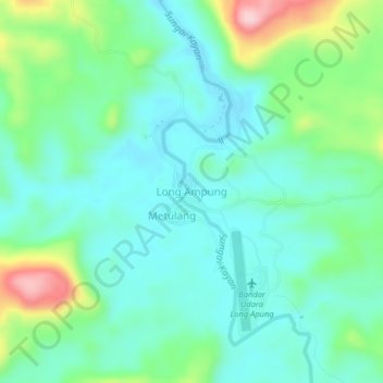
Name: Long Ampung topographic map, elevation, terrain.
Location: Long Ampung, Malinau, North Kalimantan, Kalimantan, Indonesia (1.69625 114.94476 1.73625 114.98476)
Average elevation: 681 m
Minimum elevation: 622 m
Maximum elevation: 853 m
Thank you for supporting this site ❤️
Make a donation
Make a donation