
Thank you for supporting this site ❤️
Make a donation
Make a donation
Guadual Grande topographic map
Click on the map to display elevation.
Thank you for supporting this site ❤️
Make a donation
Make a donation
About this map
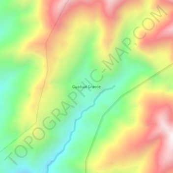
Name: Guadual Grande topographic map, elevation, terrain.
Location: Guadual Grande, Pucayacu, La Maná, Cotopaxi, Ecuador (-0.67889 -79.10437 -0.63889 -79.06437)
Average elevation: 1,310 m
Minimum elevation: 832 m
Maximum elevation: 1,876 m
Thank you for supporting this site ❤️
Make a donation
Make a donation
Other topographic maps
Click on a map to view its topography, its elevation and its terrain.