
Thank you for supporting this site ❤️
Make a donation
Make a donation
Ryan topographic map
Click on the map to display elevation.
Thank you for supporting this site ❤️
Make a donation
Make a donation
About this map
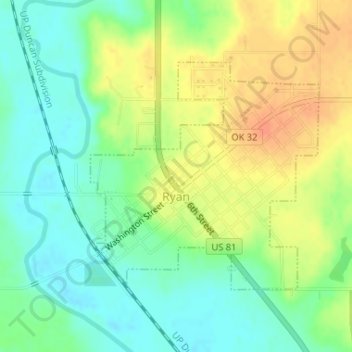
Name: Ryan topographic map, elevation, terrain.
Location: Ryan, Jefferson County, Oklahoma, 73565, United States (34.01291 -97.96547 34.03038 -97.94429)
Average elevation: 267 m
Minimum elevation: 249 m
Maximum elevation: 289 m
Thank you for supporting this site ❤️
Make a donation
Make a donation
Other topographic maps
Click on a map to view its topography, its elevation and its terrain.