Rocky Hill topographic map
Interactive map
Click on the map to display elevation.
About this map
![Rocky Hill topographic map, elevation, terrain](/pub/maps/node/4t3q/m6d6j51/thumbnail.jpg)
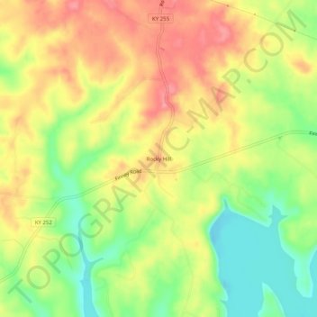
Name: Rocky Hill topographic map, elevation, terrain.
Location: Rocky Hill, Barren County, Kentucky, United States (36.92005 -86.09109 36.96005 -86.05109)
Average elevation: 206 m
Minimum elevation: 157 m
Maximum elevation: 250 m
Other topographic maps
Click on a map to view its topography, its elevation and its terrain.
![Eighty Eight topographic map, elevation, terrain](/pub/maps/node/d51h/b265tt6/icon.jpg)
Eighty Eight
United States > Kentucky > Barren County
Eighty Eight, Barren County, Kentucky, United States
Average elevation: 241 m
![Etoile topographic map, elevation, terrain](/pub/maps/node/wskl/m6th451/icon.jpg)
Etoile
United States > Kentucky > Barren County
Etoile, Barren County, Kentucky, 42131, United States
Average elevation: 246 m
![Hiseville topographic map, elevation, terrain](/pub/maps/node/pggt/lx7wggp/icon.jpg)
Hiseville
United States > Kentucky > Barren County
Hiseville, Barren County, Kentucky, 42152, United States
Average elevation: 221 m
![Austin topographic map, elevation, terrain](/pub/maps/node/lsdn/9qbbgzs/icon.jpg)
Austin
United States > Kentucky > Barren County
Austin, Barren County, Kentucky, 42123, United States
Average elevation: 216 m
![Park City topographic map, elevation, terrain](/pub/maps/relation/gtj/dx5s8/icon.jpg)
Park City
United States > Kentucky > Barren County
Park City, Barren County, Kentucky, United States
Average elevation: 201 m
![Glasgow topographic map, elevation, terrain](/pub/maps/node/1z4/xzq7g3l/icon.jpg)
Glasgow
United States > Kentucky > Barren County > Glasgow > Glasgow
Glasgow, Barren County, Kentucky, 42142, United States
Average elevation: 230 m
![Lucas topographic map, elevation, terrain](/pub/maps/node/36m2/75bsf18/icon.jpg)
Lucas
United States > Kentucky > Barren County > Lucas
Lucas, Barren County, Kentucky, 42156, United States
Average elevation: 197 m
![Cave City topographic map, elevation, terrain](/pub/maps/relation/f57/t8frr/icon.jpg)
Cave City
United States > Kentucky > Barren County
Cave City, Barren County, Kentucky, United States
Average elevation: 207 m
![Glasgow topographic map, elevation, terrain](/pub/maps/relation/zm2/v4scz/icon.jpg)
Glasgow
United States > Kentucky > Barren County
Glasgow, Barren County, Kentucky, United States
Average elevation: 230 m