
Thank you for supporting this site ❤️
Make a donation
Make a donation
South Egremont topographic map
Click on the map to display elevation.
Thank you for supporting this site ❤️
Make a donation
Make a donation
About this map
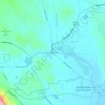
Name: South Egremont topographic map, elevation, terrain.
Average elevation: 238 m
Minimum elevation: 203 m
Maximum elevation: 477 m
Thank you for supporting this site ❤️
Make a donation
Make a donation
Other topographic maps
Click on a map to view its topography, its elevation and its terrain.
Jug End State Reservation & Wildlife Management Area
United States > Massachusetts > Berkshire County > Egremont > Mount Washington
Average elevation: 409 m