
Thank you for supporting this site ❤️
Make a donation
Make a donation
Ernage topographic map
Click on the map to display elevation.
Thank you for supporting this site ❤️
Make a donation
Make a donation
Ernage
Ernage heeft een oppervlakte van 825 ha. Het ligt op een hooggelegen plateau met verspreide heuvels. Het dorp ligt op 148 m hoogte. De bodem bestaat uit klei-, zand- en moerasgrond.
Thank you for supporting this site ❤️
Make a donation
Make a donation
About this map
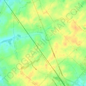
Name: Ernage topographic map, elevation, terrain.
Location: Ernage, Gembloers, Namen, Wallonië, België (50.57088 4.65584 50.60805 4.69845)
Average elevation: 157 m
Minimum elevation: 138 m
Maximum elevation: 170 m
Thank you for supporting this site ❤️
Make a donation
Make a donation
Other topographic maps
Click on a map to view its topography, its elevation and its terrain.