
Carrefour Raymond topographic map
Interactive map
Click on the map to display elevation.
About this map
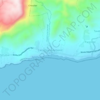
Name: Carrefour Raymond topographic map, elevation, terrain.
Average elevation: 86 m
Minimum elevation: 0 m
Maximum elevation: 564 m
Other topographic maps
Click on a map to view its topography, its elevation and its terrain.
Mahotiere
Haïti > Département du Sud-Est > Commune Jacmel > Marché > Mahotiere
Mahotiere, 11e La Montagne, Marché, Commune Jacmel, Arrondissement de Jacmel, Département du Sud-Est, Haïti
Average elevation: 409 m
D'Lo Genée
Haïti > Département du Sud-Est > Commune Jacmel
D'Lo Genée, Commune Jacmel, Arrondissement de Jacmel, Département du Sud-Est, Haïti
Average elevation: 106 m