
Leicester topographic map
Interactive map
Click on the map to display elevation.
About this map
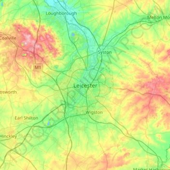
Name: Leicester topographic map, elevation, terrain.
Average elevation: 109 m
Minimum elevation: 33 m
Maximum elevation: 269 m
Other topographic maps
Click on a map to view its topography, its elevation and its terrain.
Melton Mowbray
Verenigd Koninkrijk > Engeland > Leicestershire > Melton
Melton Mowbray, Melton, Leicestershire, Engeland, LE13 0PU, Verenigd Koninkrijk
Average elevation: 103 m