
Thank you for supporting this site ❤️
Make a donation
Make a donation
Kangti topographic map
Click on the map to display elevation.
Thank you for supporting this site ❤️
Make a donation
Make a donation
About this map
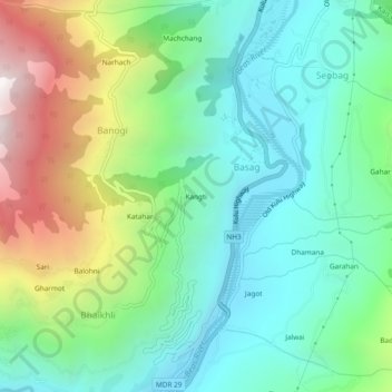
Name: Kangti topographic map, elevation, terrain.
Location: Kangti, Basag, Kullu, Himachal Pradesh, 175138, India (31.96657 77.10171 32.00657 77.14171)
Average elevation: 1,677 m
Minimum elevation: 1,196 m
Maximum elevation: 2,782 m
Thank you for supporting this site ❤️
Make a donation
Make a donation