
Thank you for supporting this site ❤️
Make a donation
Make a donation
Woolton Hill topographic map
Click on the map to display elevation.
Thank you for supporting this site ❤️
Make a donation
Make a donation
About this map
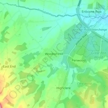
Name: Woolton Hill topographic map, elevation, terrain.
Average elevation: 126 m
Minimum elevation: 91 m
Maximum elevation: 216 m
Thank you for supporting this site ❤️
Make a donation
Make a donation
Other topographic maps
Click on a map to view its topography, its elevation and its terrain.
Thank you for supporting this site ❤️
Make a donation
Make a donation
Whitchurch
United Kingdom > England > Hampshire > Basingstoke and Deane > Whitchurch
Average elevation: 108 m