
Thank you for supporting this site ❤️
Make a donation
Make a donation
Ursenbach topographic map
Click on the map to display elevation.
Thank you for supporting this site ❤️
Make a donation
Make a donation
Ursenbach
Das Klima in Ursenbach ist mit einer Jahrestemperatur von 7,5 °C deutlich kühler als in der nur 6 km entfernten Bergstraße im Schnitt 3 °C. Auch die Niederschlagsmenge von 1065 mm ist deutlich höher. Die 50 Schneetage und die Schneehöhen die auch 50 cm erreichen können, sind viel höher.
Thank you for supporting this site ❤️
Make a donation
Make a donation
About this map
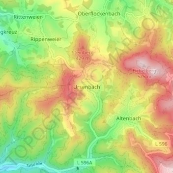
Name: Ursenbach topographic map, elevation, terrain.
Average elevation: 331 m
Minimum elevation: 172 m
Maximum elevation: 508 m
Thank you for supporting this site ❤️
Make a donation
Make a donation
Other topographic maps
Click on a map to view its topography, its elevation and its terrain.