
Thank you for supporting this site ❤️
Make a donation
Make a donation
Hodgesville topographic map
Click on the map to display elevation.
Thank you for supporting this site ❤️
Make a donation
Make a donation
About this map
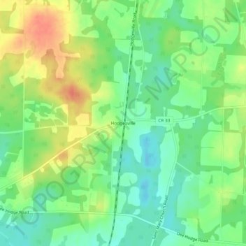
Name: Hodgesville topographic map, elevation, terrain.
Location: Hodgesville, Houston County, Alabama, United States (31.06268 -85.39299 31.10268 -85.35299)
Average elevation: 64 m
Minimum elevation: 43 m
Maximum elevation: 91 m
Thank you for supporting this site ❤️
Make a donation
Make a donation
Other topographic maps
Click on a map to view its topography, its elevation and its terrain.
Thank you for supporting this site ❤️
Make a donation
Make a donation
Thank you for supporting this site ❤️
Make a donation
Make a donation