
Thank you for supporting this site ❤️
Make a donation
Make a donation
Harat al Hawatim topographic map
Click on the map to display elevation.
Thank you for supporting this site ❤️
Make a donation
Make a donation
About this map
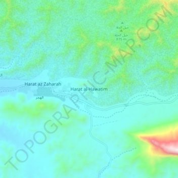
Name: Harat al Hawatim topographic map, elevation, terrain.
Location: Harat al Hawatim, Ad Dhahirah Governorate, Oman (23.24359 56.90418 23.32359 56.98418)
Average elevation: 834 m
Minimum elevation: 655 m
Maximum elevation: 1,739 m
Thank you for supporting this site ❤️
Make a donation
Make a donation
Other topographic maps
Click on a map to view its topography, its elevation and its terrain.