
Thank you for supporting this site ❤️
Make a donation
Make a donation
Leatherwood topographic map
Click on the map to display elevation.
Thank you for supporting this site ❤️
Make a donation
Make a donation
About this map
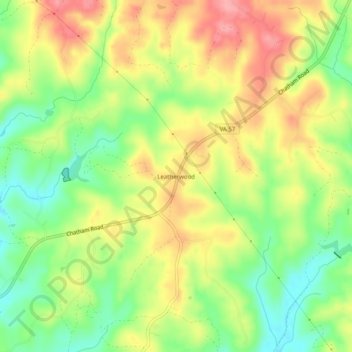
Name: Leatherwood topographic map, elevation, terrain.
Location: Leatherwood, Henry County, Virginia, United States (36.72097 -79.76642 36.76097 -79.72642)
Average elevation: 269 m
Minimum elevation: 220 m
Maximum elevation: 319 m
Thank you for supporting this site ❤️
Make a donation
Make a donation
Other topographic maps
Click on a map to view its topography, its elevation and its terrain.