
Thank you for supporting this site ❤️
Make a donation
Make a donation
Sixes topographic map
Click on the map to display elevation.
Thank you for supporting this site ❤️
Make a donation
Make a donation
About this map
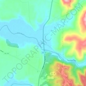
Name: Sixes topographic map, elevation, terrain.
Location: Sixes, Curry County, Oregon, United States (42.80011 -124.50316 42.84011 -124.46316)
Average elevation: 62 m
Minimum elevation: 4 m
Maximum elevation: 220 m
Thank you for supporting this site ❤️
Make a donation
Make a donation
Other topographic maps
Click on a map to view its topography, its elevation and its terrain.