
Thank you for supporting this site ❤️
Make a donation
Make a donation
Corinth topographic map
Click on the map to display elevation.
Thank you for supporting this site ❤️
Make a donation
Make a donation
About this map
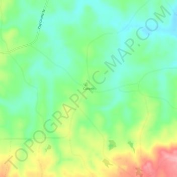
Name: Corinth topographic map, elevation, terrain.
Location: Corinth, Clay County, Alabama, 36255, United States (33.18540 -85.71163 33.22540 -85.67163)
Average elevation: 266 m
Minimum elevation: 221 m
Maximum elevation: 347 m
Thank you for supporting this site ❤️
Make a donation
Make a donation
Other topographic maps
Click on a map to view its topography, its elevation and its terrain.